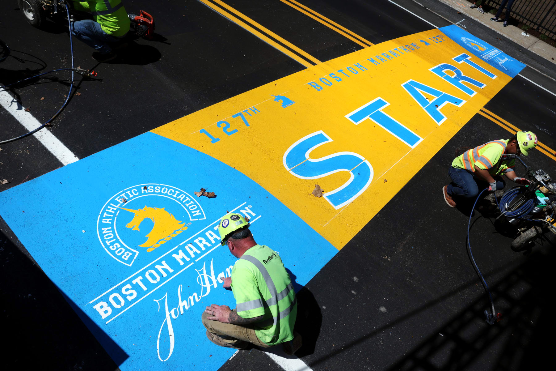
Boston Marathon 2023: Route, Course Map, Times, Road Closures and Event Details
The 127th Boston Marathon, which will be run on Monday, April 17—Patriots' Day—will feature 30,000 entrants from 122 countries, representing all 50 states.
It's a milestone year for the world's oldest marathon. It's the first year the race will feature a division for nonbinary runners, joining New York and Chicago as other major marathons to have expanded their inclusivity. The London Marathon on April 23 will also feature its first nonbinary runner category.
This year's Boston Marathon also features a notable pool of elite athletes, including Olympians and Paralympians. Eliud Kipchoge is a favorite to set the men's course record in his attempt to win all six World Marathon Majors. The standing record of 2:03:02 was set by Kenya's Geoffrey Mutai in 2011.
In the women's field, Amane Beriso, who last year ran the third-fastest marathon of all time, and reigning world champion Gotytom Gebreslase are names to know.
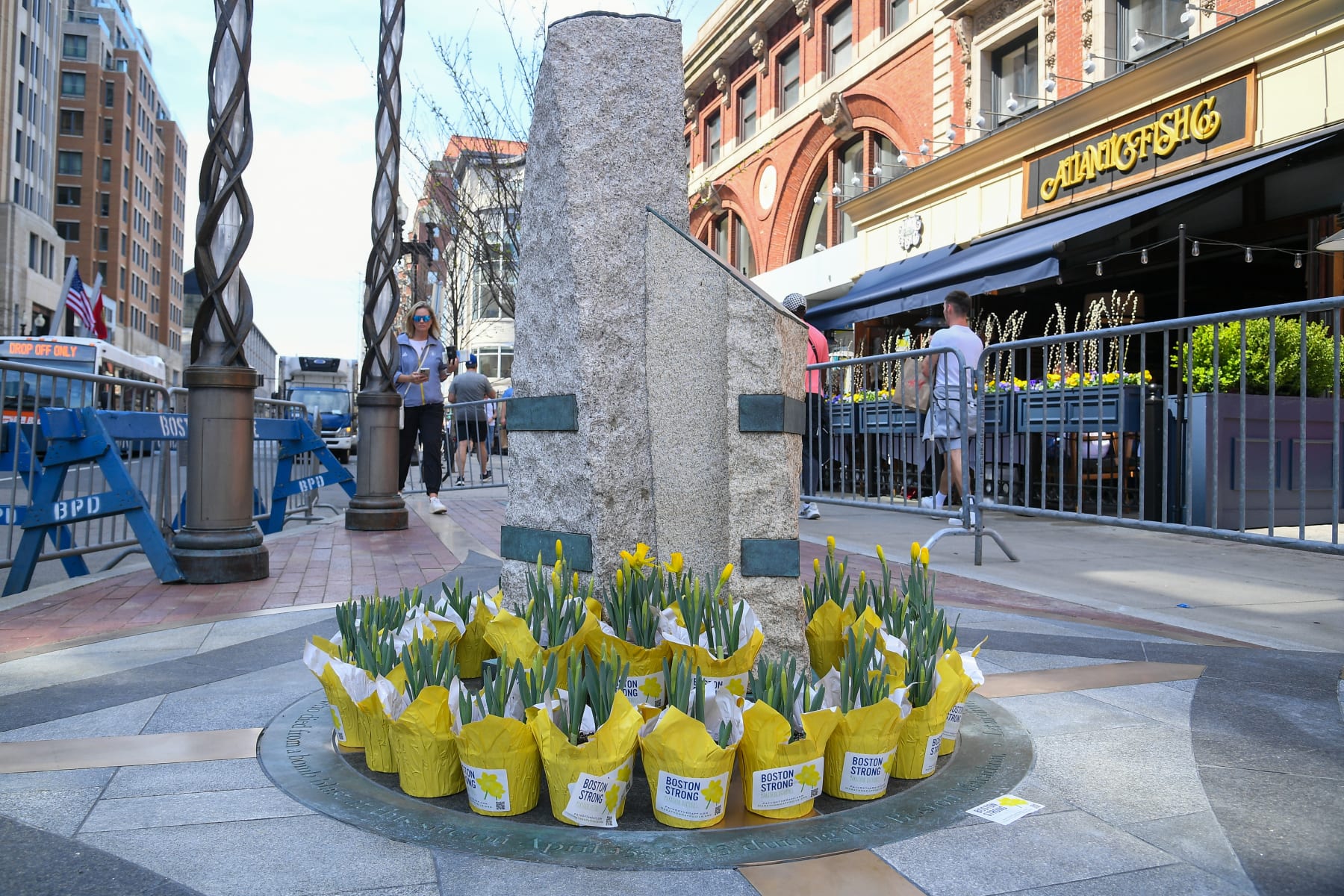
This year's running of the marathon also marks the 10th anniversary of the Boston Marathon bombing. On Saturday, the city observed the One Boston Day remembrance event to honor the victims, survivors and first responders of the 2013 marathon.
Saturday afternoon, the city dedicated a new commemorative Boston Marathon finish line and unveiled a One Boston Day marker on Boylston Street. In attendance were Governor Maura Healey, Mayor Michelle Wu, Boston Athletic Association leadership, members of the One Fund community, members of the 2013 Red Sox team, first responders, hospital leaders and local running groups.
On Sunday, April 16, members of the 2013 Red Sox World Series team reunited during pregame ceremonies. And on Monday, Hall of Famer David Ortiz will serve as the marathon's Grand Marshal. Fans in attendance will receive a Boston Strong T-shirt.
However you're planning to watch this year's marathon, from afar or from the finish line, below you'll find all the information you need to know about start times, the course map and road closures.
Boston Marathon Event Details
Date: Monday, April 17
Start: Hopkinton, Mass.
Finish: Copley Square, Boston, Mass.
Start time:
- Men's wheelchair field: 9:02 a.m. ET
- Women's wheelchair field: 9:05 a.m.
- Handcycles and Duos: 9:30 a.m.
- Professional men: 9:37 a.m.
- Professional women: 9:47 a.m.
- Para Athletics Division: 9:50 a.m.
- Wave 1: 10 a.m.
- Wave 2: 10:25 a.m.
- Wave 3: 10:50 a.m.
- Wave 4: 11:15 a.m.
How to watch: WCVB Channel 5 locally; ESPN nationally
Boston Marathon Route and Course Map
Whether you've run the Boston Marathon, are running it for the first time, or plan to watch in person or on TV, the sights of Boston from Hopkinton to Copley Square are on full display along the marathon route.
The race officially begins in Hopkinton, a suburb about 26 miles (well, look at that) outside of the city center.
Runners follow Route 135 through Ashland, Framingham, Natick and Wellesley to Route 16, where they'll then run by Newton Lower Falls before arriving at Commonwealth Ave. (Route 30).
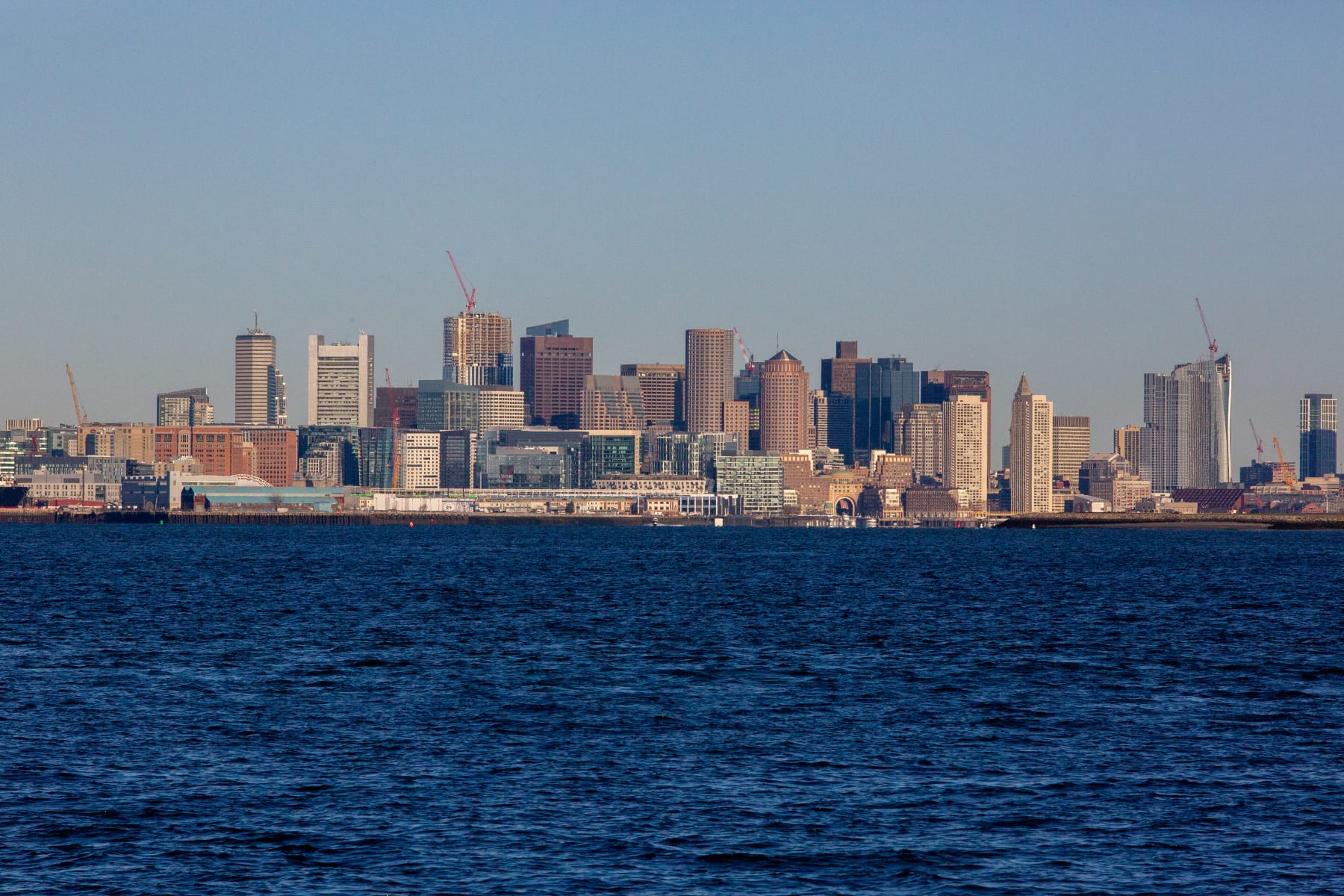
Next, runners embark on the most iconic part of the course, following Commonwealth Ave. through the Newton Hills and to Chestnut Hill Ave. along the infamous Heartbreak Hill. Getting into the city proper, the route then travels through Beacon Street, Brookline, Kenmore Square and under Massachusetts Ave., before finally taking Boylston Street to the finish at Boston Public Library in Copley Square.
The official Boston Marathon course map can be viewed on the Boston Athletic Association's website.
Boston Marathon Road Closures
Unsurprisingly, given the Boston Marathon's famously scenic route throughout the entire city, there is a correspondingly significant effect on road closures, parking restrictions and MBTA adjustments.
The areas of the city most impacted by these restrictions are Back Bay, Beacon Hill, Brighton, Fenway-Kenmore, North End and Government Center.
To move about freely, Boston officials recommend that marathon viewers walk, look into Bluebike rentals on the Bluebikes website or consult the MBTA website for public transportation options.
A list of street closures and restrictions put out by Boston.gov can be found below:
No Stopping April 5–20
- Blagden Street, (south side, opposite side of Library) Huntington Avenue to Exeter Street for HP parking
- Boylston Street, (both sides) Exeter Street to Dartmouth Street
- Boylston Street, Dartmouth Street (from Dartmouth Street to Clarendon Street)
- Exeter Street, Boylston Street to Blagden Street
No Stopping April 10–20
- Blagden Street, Dartmouth Street to BPL Driveway
No Stopping April 12–18
- Exeter Street, Alley 441 to Boylston Street
No Stopping April 13–17
- Trinity Place, St. James Avenue to Stuart Street
- NO STOPPING FRIDAY, SATURDAY, AND MONDAY - APRIL 14, 15, AND 17
- Beacon Street, Charles Street to Joy Street
- Boylston Street, Dalton Street to Arlington Street, unless otherwise posted
- Clarendon Street, Newbury Street to Saint James Avenue
- Dartmouth Street, Boylston Street to Commonwealth Avenue
- Exeter Street, Newbury Street to Huntington Avenue, No Stopping Thursday to Monday, and east side from Boylston Street to Blagden Street.
No Stopping Saturday to Monday April 15–17
- Beacon Street, Bay State Road to Brookline Town Line (both sides)
- Berkeley Street, Stuart Street to Newbury Street
- Boylston Street, Arlington Street to Charles Street
- Cambridge Street, Court Street to Sudbury Street
- Charles Street, Boylston Street to Beacon Street
- Saint James Avenue, Arlington Street to Clarendon Street
- Stuart Street, Huntington Avenue to Arlington Street
No Stopping Sunday and Monday April 16 and 17
- Clarendon Street, Newbury Street to Public Alley 436
- Newbury Street, for Media Vehicles from #29 Newbury Street crossing over Berkeley Street to #69 Newbury Street
No Stopping Saturday 12:01 a.m. ET through 3 p.m. ET on April 17
- Newbury Street, Dartmouth Street to Exeter Street
- NO STOPPING MONDAY, APRIL 17
- Arlington Street, Beacon Street to Stuart Street
- Arlington Street, Columbus Avenue to Isabella Street
- Beacon Street, Brighton from Chestnut Hill Avenue to Brookline Town Line
- Beacon Street, Back Bay from Charles Street to Arlington Street
- Berkeley Street, Columbus Avenue to Commonwealth Avenue, unless otherwise posted
- Belvidere Street, Huntington Avenue to Massachusetts Avenue
- Blagden Street, Huntington Avenue to Exeter Street, unless otherwise posted
- Boylston Street, from Massachusetts Avenue to Dalton Street
- Charles Street, from Boylston Street to Beacon Street
- Charles Street South, from Park Plaza to Boylston Street
- Chestnut Hill Avenue, from Commonwealth Avenue to Beacon Street
- Clarendon Street, from Commonwealth Avenue to Columbus Avenue, unless otherwise posted
- Cleveland Circle, (Parking area adjacent to Cassidy Playground & parking area adjacent to Sutherland Road) from Beacon Street to Chestnut Hill Avenue, 24 hours
- Columbus Avenue, from Arlington Street to Dartmouth Street
- Commonwealth Avenue, from Charlesgate West to Deerfield Street (outbound)
- Commonwealth Avenue, from Beacon Street (Kenmore Square) to 80 feet east of Hereford Street.
- Commonwealth Avenue, from Lake Street to Chestnut Hill Avenue (inbound)
- Congress Street, from State Street to Hanover Street
- Dalton Street, from Boylston Street to Clearway Street
- Dartmouth Street, from Newbury Street to Commonwealth Avenue and Saint James Avenue to Columbus Avenue
- Deerfield Street, from Commonwealth Avenue to Bay State Road
- East Dedham, Street from Harrison Avenue to Albany Street
- Exeter Street, from Commonwealth Avenue to Newbury Street
- Fairfield Street, from Boylston Street to Commonwealth Avenue
- Gloucester Street, from Commonwealth Avenue to Boylston Street
- Hereford Street, from Commonwealth Avenue to Boylston Street
- Hanover Street, (both sides) from Congress Street to Commercial Street
- Huntington Avenue, from Blagden Street to Massachusetts Avenue
- Kenmore Street, from Newbury Street to Beacon Street
- Nassau Street, (both sides) from Washington Street to Harrison Avenue
- New Chardon Street, from Merrimac Street to Cambridge Street
- Newbury Street, from Arlington Street to Brookline Avenue
- Plympton Street, from Harrison Avenue to Albany Street
- Providence Street, from Arlington Street to Berkeley Street
- Raleigh Street, from Bay State Road to Beacon Street
- State Street, (both sides) from Congress Street to Washington Street
- Stanhope Street, from Berkeley Street to Clarendon Street
- Scotia Street, from Dalton Street to St. Cecilia Street
- St. Cecilia Street, from Belvidere Street to Boylston Street
- Tremont Street, (both sides) from Cambridge Street/Beacon Street to Stuart Street
- Washington Street, Both sides, from Oak Street to Nassau Street. East side (even side), from Nassau Street to Kneeland Street
- Washington Street, (both sides) from Winter Street to State Street
- Winter Street, (both sides) from Tremont Street to Washington Street